
June 6-8 was OpenStreetMap’s State of the Map Conference at the United Nations. I volunteered at registration and during morning sessions and was able to attend interesting talks on OSM data in Wikipedia, the Red Cross presentation on OSM in disaster response and developing a GIS curriculum in higher education.
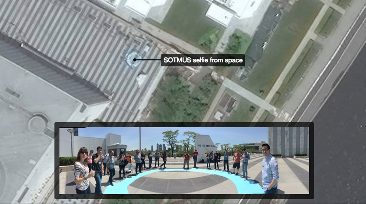
One of the highlights was a satellite selfie. Led by a team from DigitalGlobe, a group of about 20 attendees created a large UN-blue circle on the ground and waited for the WorldView 3 and GOI1 satellites to flyover for a routine scan. Orbiting at 15,000 miles per hour about 400 kilometers above Manhattan, the WorldView 3 was expected to take images that would include UN Plaza. The resulting satellite image collected at 11:44am is available on the CartoDB blog (image above), courtesy of CartoDB CEO, Javier de la Torre. Huge thanks to Josh Winer of DigitalGlobe who took time to explain the physics of satellite imagery and kept us entertained while we waited for our not-so-closeup.